Field Methods
Breeding Population Monitoring
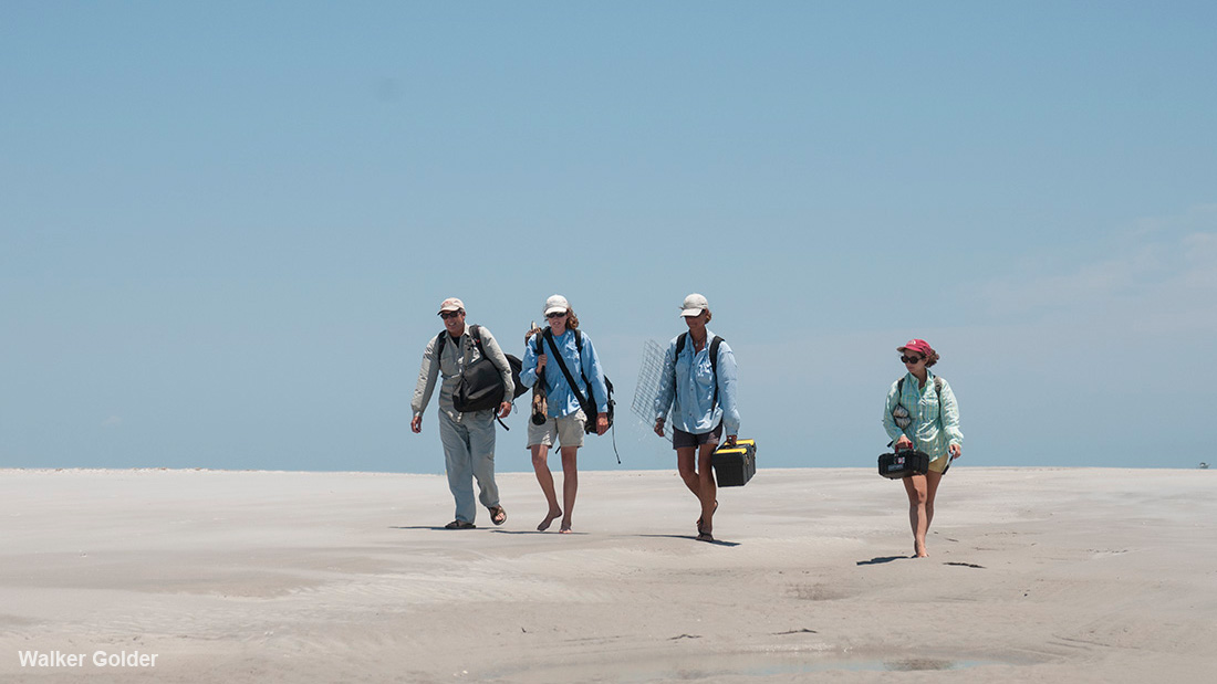
Many members of the American Oystercatcher Working Group conduct surveys to locate breeding American Oystercatchers. These surveys are completed on foot or from a vehicle or boat in areas of American Oystercatcher breeding habitat. American Oystercatchers are generally conspicuous and easy to locate. We look for oystercatchers in pairs and exhibiting territorial behavior, which we identify as a breeding pair. We then look for the pair’s nest within their established territory. Once we locate a nest, we check it frequently to determine how long it survives and when it hatches or fails.
Sometimes we’re unable to determine why a nest fails if it disappears and there is no sign of what happened. Nests may be predated by various other animals which eat the oystercatcher eggs, or the eggs may be washed away by water. In an attempt to know what may have happened to the nest when we can’t be there to actually see it, we have developed methods to give us clues as to what occurred in our absence. Video cameras are used to record activity at and around the nests. We may partially bury a plastic cup with holes in the sides near a nest. If the cup is found with salt water in it, the area was washed over by high water.
Capturing
Some of our research involves collecting body measurements and affixing identifying leg bands on the oystercatchers. To do this we must capture the oystercatchers. We can capture oystercatchers using a variety of techniques, some of which are more ideal for different individuals or locations. We use American Oystercatcher decoys and recordings of oystercatcher vocalizations to attract the individuals we are targeting, then use nets, traps, or leg nooses to capture them.
Banding and Measuring
Once captured, we often weigh the oystercatcher and measure its wings, bill, and legs. We also affix metal and colored bands or flags on the legs of the oystercatchers. These bands/flags are stamped with a unique letter/number code which will identify an individual oystercatcher.
Resighting
Colored and coded bands and flags placed on the legs of American Oystercatchers identify individual oystercatchers without the need to disturb or capture them. People can use binoculars, spotting scopes, or cameras with zoom/telephoto lenses to read the codes on the bands or flags from a distance away from the oystercatcher. While binoculars and spotting scopes are the traditional tools used for band resighting, and remain extremely useful in many situations, modern cameras with powerful zoom lenses and image stabilization have proved invaluable in collecting data not otherwise obtainable via stationary position scope observation. For example, many oystercatchers roost on docks, jetties, or other structures that do not permit a person to approach on land and set up a scope. On a boat, scopes are generally not useful, but a camera can capture bands with relative ease. Additionally, once viewed at full resolution, photographs of flocks sometimes reveal bands that had not been detected in the field. The photos also provide a record for verification. SLRs with 300mm lenses or greater have proven useful, as well as cheaper point and shoot models with 50x optical zooms. In all cases, however, it is important to avoid disturbance to flocks while reading bands. When bands are reported, researchers can then track the locations and movements of individual oystercatchers.
See the results of a camera resight experiment on the North Carolina page.
Radio Telemetry
Chick mortality often remains an unknown aspect of nest failure. It is difficult to observe mortality events and causes. Visual observation is time-consuming and intrusive, and stationary video cameras are usually unable to capture what happened to chicks once they become mobile and leave the nesting site. However, radio telemetry can be used to determine when mortality occurs by tracking chick movements (or lack thereof).
Radio telemetry involves attaching a VHF radio transmitter to a chick, which broadcasts a single-frequency radio signal. That single-frequency signal is unique to one individual chick and is tracked with an antenna and signal receiver. Chicks may be tracked until they can fly. Sometimes they are followed after fledging as long as they continue to return to their natal site with their parents or by using an airplane. By tracking the chick, we can monitor its location. From this, we can determine local movement, dispersal, behaviors, and survival.
Radio transmitters can be attached in various ways. They are often attached to leg bands when the chicks get older. Younger chicks may have them glued to their back. Since the birds are growing, we have to be careful that our attachments are not too heavy and that they do not inhibit growth of the chicks.
Mortality has usually occurred when a signal is continually originating from the same location. When this occurs, we can use the telemetry to locate the transmitter and chick, then try to determine the cause of mortality from signs and indicators on the chick and in the surrounding area. Sometimes, however, it is still difficult to determine what killed the chick because weather and scavengers cause sign to disappear quickly. Occasionally the chick and transmitter are carried out of range of the receiver and the signal can no longer be heard or followed, so again, we have no way of knowing what happened to it. But, overall, radio telemetry increases our chances of knowing the fate of chicks.
Satellite Tracking
In the spring and summer of 2013, six adult oystercatchers were outfitted with 9.5-gram solar powered satellite transmitters in order to study habitat use and migration strategies, as well as provide a portal for public interaction with and education about the species. A website, oystercatchertracking.org was created for internet users to follow the birds, two of which were successfully tracked on their migrations to Capers Island, South Carolina and Cedar Key, Florida. In subsequent years, we hope to deploy additional transmitters, including more advanced models that will provide GPS points for finer scale evaluation of habitat use during breeding, migration, and wintering.